
A Lombok waterfalls map can look deceptively simple. Two famous waterfall areas may appear to sit on the same island, yet reaching them can mean heading in quite different directions and spending very different portions of the day on the road.
For practical orientation, think of Lombok’s well-known waterfall country as two broad zones. Benang Stokel and Benang Kelambu are in Central Lombok, inland toward the Mount Rinjani landscape. Sendang Gile and Tiu Kelep sit much farther north around Senaru. That distinction matters more than trying to decide which waterfall looks better in a photograph.
For cruise passengers, geography becomes even more important. Starting from Gili Mas Port or Lembar Port means the available day is shaped by the ship’s timing as much as the map. A route that makes sense for a hotel guest with a free evening may be uncomfortable for somebody who must be back aboard before departure.
Lombok Waterfalls Map Starts With Two Different Regions
Central Lombok is the easier region to understand first. The Benang waterfall area lies inland, away from the southern beaches and west-coast resort strip. Roads move toward greener country as the route approaches the foothills around the Mount Rinjani landscape.
North Lombok is another proposition. Sendang Gile and Tiu Kelep are associated with the Senaru area on the northern side of the island. Reaching this zone from Lombok’s southwest means committing to a considerably longer cross-island journey.
This regional split is useful when looking at waterfall shore excursions in Lombok. A pin on a digital map tells you where the water falls. It does not tell you how comfortably that location fits between port pickup and the time you need to be back.
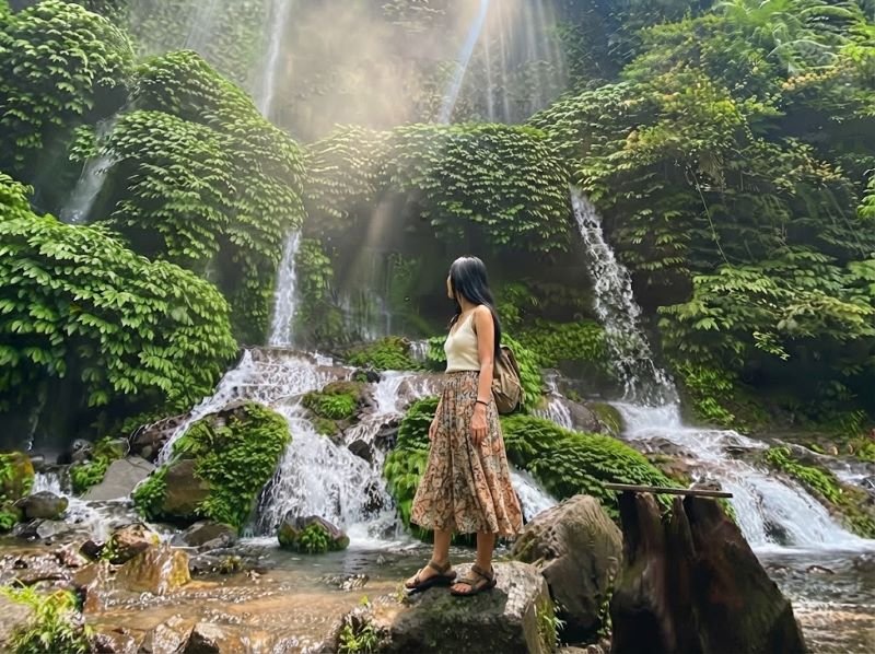
Benang Stokel and Benang Kelambu Sit in Central Lombok
Benang Stokel and Benang Kelambu belong to the same general Central Lombok waterfall zone. That makes them geographically logical to consider together rather than treating each name as a completely separate trip across the island.
From the southwest port area, the route heads inland. From Kuta Lombok, you are also approaching from the south, while travelers based around central parts of the island have a more direct relationship with this waterfall region than those staying far to the north.
There is another practical advantage to thinking by region. If conditions or timing change, you are dealing with one general area rather than trying to connect attractions scattered across opposite sides of Lombok. For a cruise day, that can make route discussions much more realistic.
Sendang Gile and Tiu Kelep Belong to the Senaru Zone
Move your attention to the north of a Lombok waterfalls map and the picture changes. Sendang Gile and Tiu Kelep are reached through the Senaru area, close to the northern side of Mount Rinjani. This is not simply the next waterfall stop after Benang Kelambu.
Senaru makes much more geographical sense when you are already in northern Lombok or when your day has enough room for the drive. From the southwest, road time becomes a serious part of the decision. A cruise passenger also needs to leave enough margin for the return rather than treating the ship’s departure time as the target arrival time at port.
If your interest is broader than waterfalls alone, looking at nature shore excursions in Lombok can help put these mountain areas in context with other landscapes that may fit a limited port day differently.

Which Bases Are Closest to Each Waterfall Zone?
Your starting point changes how a Lombok waterfalls map should be read. Kuta Lombok sits in the south, so the Central Lombok waterfall zone is generally the more natural direction compared with traveling all the way to Senaru. The same broad logic applies when beginning from Lombok’s southwest port area.
Senggigi is farther up the west coast. From there, heading north toward the Senaru side follows a different geographical pattern than starting from Lembar or Gili Mas. Even so, Senaru should not be treated as a quick detour. Lombok’s roads and terrain matter, and map distance alone can give a poor impression of how a day will actually feel.
If you are staying around Senaru, the calculation flips. Sendang Gile and Tiu Kelep become the local waterfall zone, while crossing toward the Benang area means leaving the region you are already in.
How Geography Changes a Cruise Day Trip
A Lombok waterfalls map is useful for orientation, but on a cruise day the question is rarely just “Can we drive there?” A better question is whether the route leaves enough breathing room after allowing for pickup and the return journey. Weather can interfere too. Traffic or local operating conditions may change what is sensible on the day.
This is why we prefer to look at the ship’s arrival and required return timing before treating a map route as a plan. A private car gives you room to adjust the day, but it does not make Lombok smaller.
For travelers who want to compare a waterfall day with other directions around the island, Lombok private tours provide a wider starting point for discussing what can realistically fit into the hours available ashore.
Can You Combine the Central and Northern Waterfall Zones?
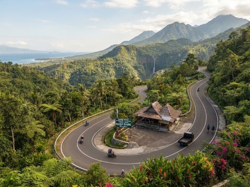
Geographically, they are separate enough that combining them should not be the default assumption, especially on a cruise call. Trying to collect waterfall names can turn a nature day into a long driving day. For most port planning, choosing the region that fits your starting point and available hours is the more useful conversation.
Is Benang Kelambu near Sendang Gile?
Not in practical day-trip terms. Benang Kelambu is in Central Lombok, while Sendang Gile is around Senaru in North Lombok. They belong to different route zones.
Which waterfall area is closer to Kuta Lombok?
The Benang Stokel and Benang Kelambu area is geographically the more natural choice from Kuta Lombok compared with traveling north to Senaru. Actual travel time still varies with road conditions and your pickup point.
Which waterfall zone makes more sense from Gili Mas Port?
Central Lombok is generally the first region worth discussing because Gili Mas is on the southwest side of Lombok. Whether a waterfall visit fits your particular cruise call still depends on docking time and the safe return window.
Does a Lombok waterfalls map show realistic driving time?
Not by itself. It is excellent for understanding direction and relative location, but road character can make two apparently similar distances feel very different. Cruise travelers should plan around usable hours rather than distance alone.
Should cruise passengers choose a waterfall before checking ship timing?
We would do it the other way around. Check the ship schedule and pickup situation first, then choose the waterfall region that leaves a sensible margin for getting back. Sea conditions and local operations can also affect the day’s practical timing.
Use the Map to Choose a Direction Not Just a Pin
The most useful way to read a Lombok waterfalls map is to see regions rather than isolated attractions. Benang Stokel and Benang Kelambu point you toward Central Lombok. Sendang Gile and Tiu Kelep pull the day toward Senaru in the north. Once you see that split, route planning becomes much clearer.
If you are arriving by cruise, reserve your private Lombok shore excursion through the official website and ask Wayan and the team to review your arrival time and pickup point. They can discuss the waterfall zone you have in mind, the time available ashore, and a realistic return plan before the route is confirmed. The itinerary should always remain flexible because ship operations, weather and road conditions can change the day.